Our company provides Mobile mapping systems, and 3D reconstruction solutions. We develop 2D and 3D GIS softwares on mobile and desktop. We are experienced in developing GIS applications, and data integration for municipalities, and other organisations.
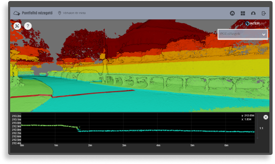
Public roads survey
Up to 100 kilometers road survey per day
- Time and cost efficient
- Without roadblocks
- Photo documentary
- Record the current status

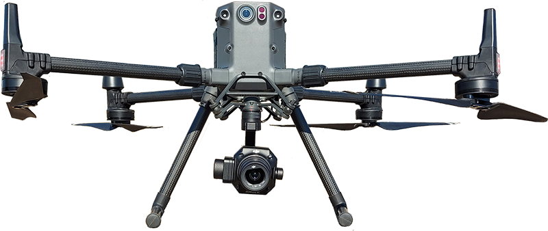
GeoMeter
New generation Mobile 3D Mapping system
- New technology
- Can be mounted on a vehicle
- Automated data processing (AI)


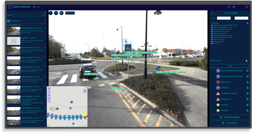
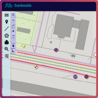
GIS
The assets of the settlement can be seen on the same platform
- Control plan display
- Utilities
- Scale printing
- Topographic number and address search function
- Thematic map

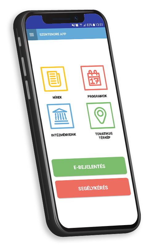
Smart City App
Two way communication between the citizens and government
- Authentic information
- Public report
- Questionnaires
- Push message


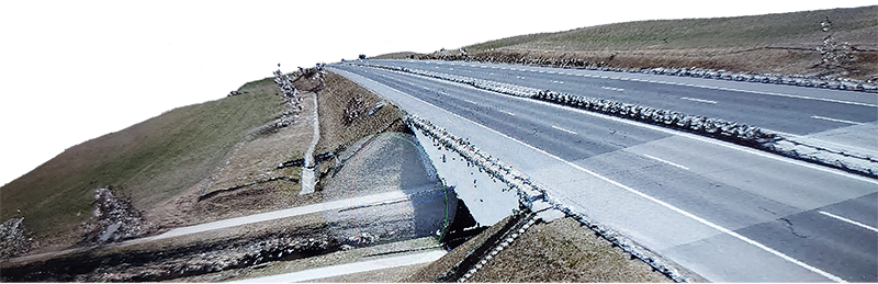
Drone survey
Surveying with drones
- Fast field survey
- Spectacular models
- Extensive usage
- High accuracy
- Many output - pointcloud, 3D model, DEM , orthophoto