Szécheny 2020Szécheny 2020

geometer

New generation Mobile 3D Mapping system

  • Survey hundreds of kilometers in a day without road closures
  • Clever mapping equipment that replaces costly and time consuming field surveys
  • Plenty of various data and information is registered

TheGeoMeterconsist of a few mobile parts, which can be assembled just in a couple of minutes.

GeoMeter

A head with a robust and durable construction, high-resolution cameras and an INS module with centimeter accuracy is the basis of the GeoMeter survey device.
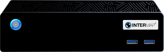
Blackbox

A high-performance computer ensures the smooth conduct survey and that images are processed in real time.

Controller

Through our own developed software, we can monitor and control the survey, view the images and the routes taken.

Easy to use!

1

Set up GeoMetert

GeoMeter must be first attached to the roof rack of a car and connected to blackbox and the controller.

2

Tracking

By the controller start recording the paths. Due to the recent innovations, like the touchscreen, it is more simple than ever, moreover you get a realtime follow-up of all feedbacks, information, pictures etc. during the surveying process.

3

Download data

After the survey is finished import the data with the Loader desktop and export directly into the ForteMap system or into any other softwares. Due to the cost-efficient GeoMeter surveying plenty of various data and information is registered besides the photo documetation. We are dedicated to help our customers to make their business more profitable with more automated, efficient and faster.

4

Processing

Use the ForteMapAI object recognition and localization module to retrieve survey data. After photogrammetric processing, a 3D point cloud can also be extracted.

5

View the result!

In the ForteMap GIS system the results of the survey can be managed and edited or imported into external systems.

Pointcloud

3D model

Objects

Positioned images

HD ortophoto

Road data

3D Survey logo

Our partner company, the 3D Survey

The device can be purchased for road and other surveys. Already after surveying 1000 km of road, the investment pays off

Intermap logo

InterMap Kft. 1023 Budapest, Vérhalom utca 18/A


+36 20 398 9077 geometer@intermap.hu

IVSZMI koalíció